


Built to be simple to use in the field and powerful in the back office, GeoViewer map-based Enterprise Operations Management is the fastest, most diverse & maintenance free cloud-based solution for local government, and private organizations.
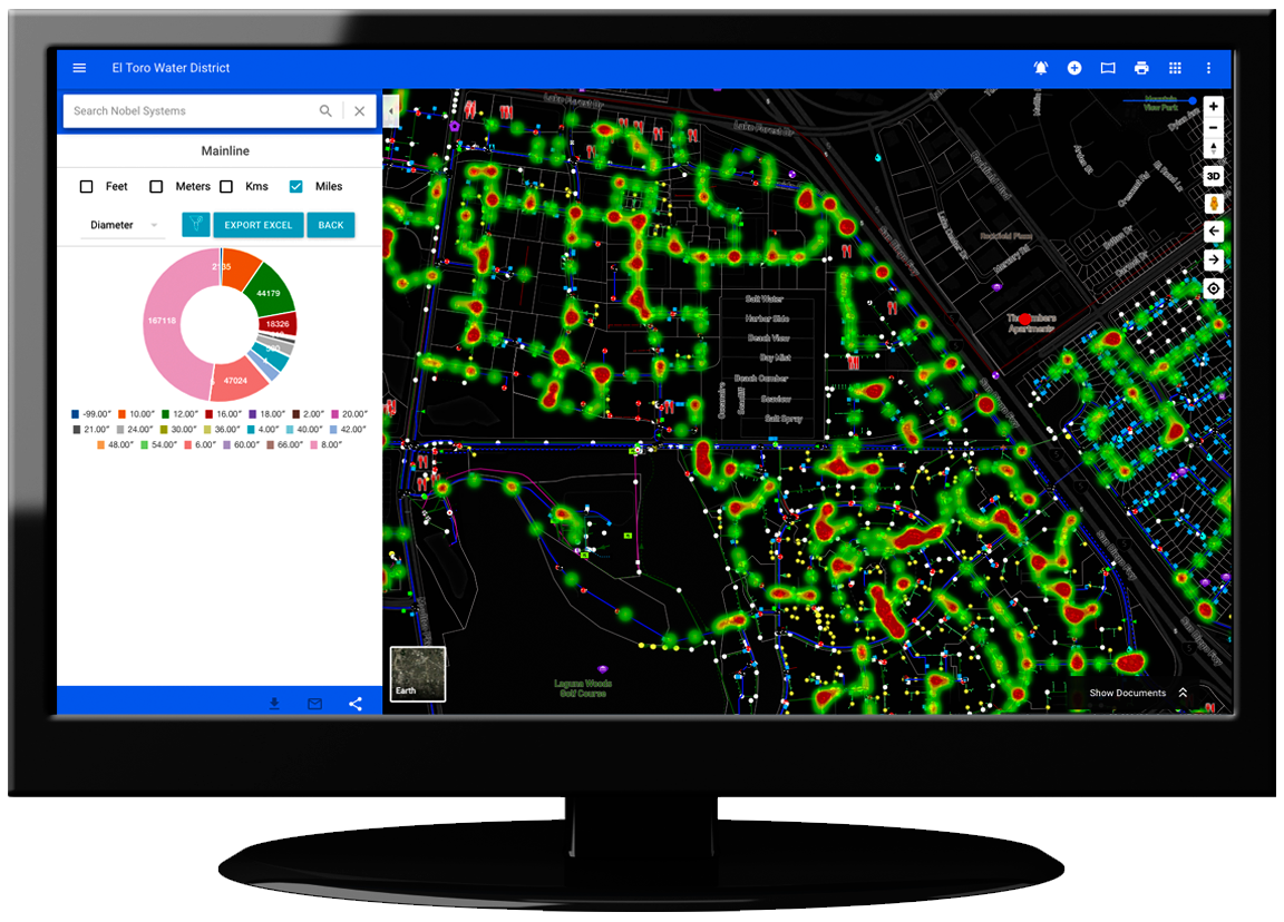
Whether you simply want to stop using paper for your work orders, utilize your GIS data, integrate your billing & inventory systems, monitor water quality in real time, or run an analysis to predict pipeline failures, GeoViewer has the solution for you.


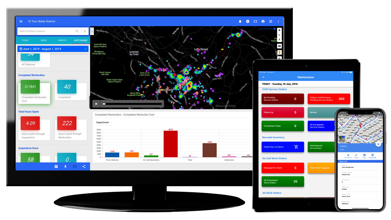
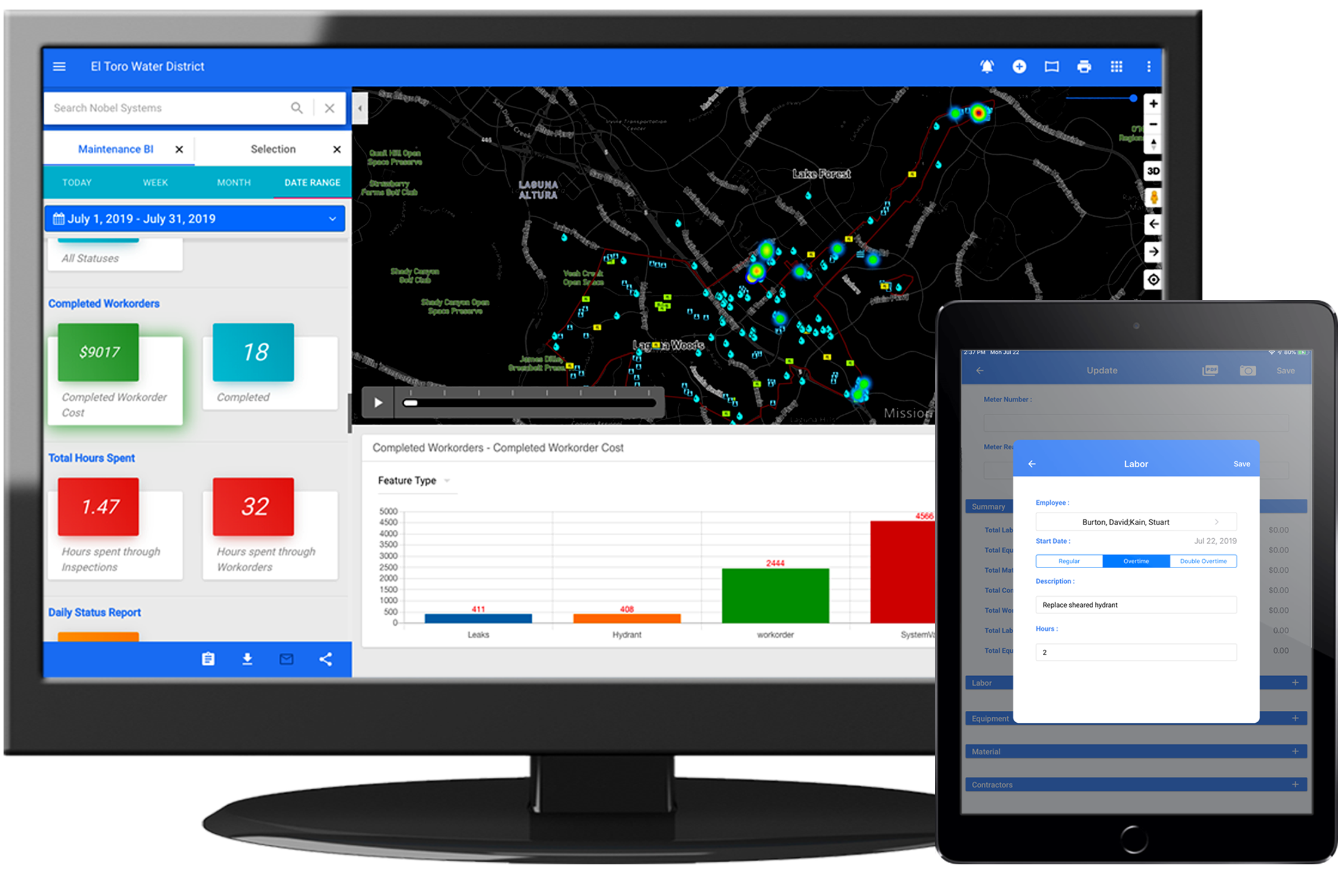
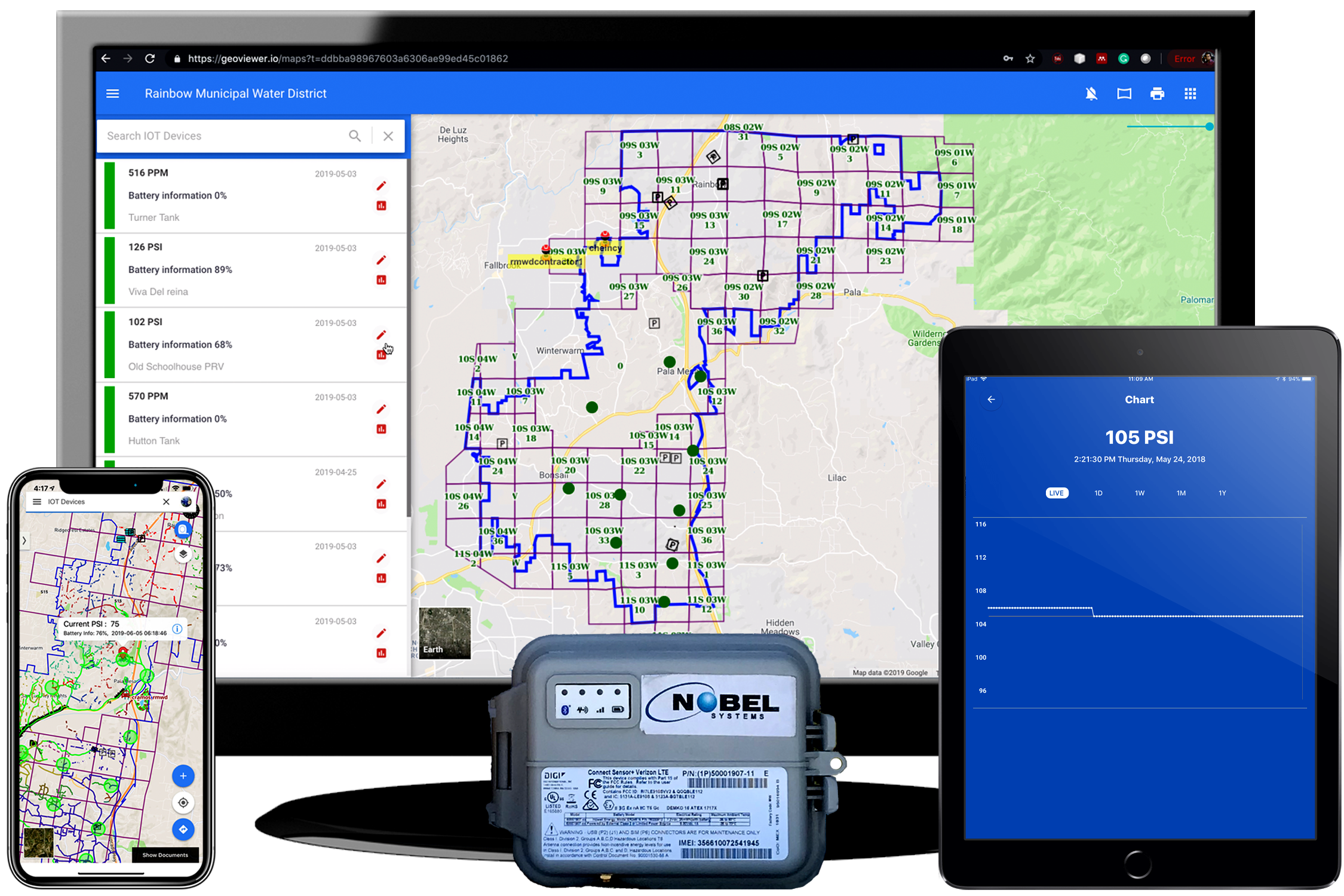
With GeoViewer Online, it’s simple to monitor all daily operations in real time all from a click-of-a-button.
With impressive BI & GIS based reporting, streamlined work management, powerful analysis tools, and connected device monitoring, Operations Management has never been simpler.
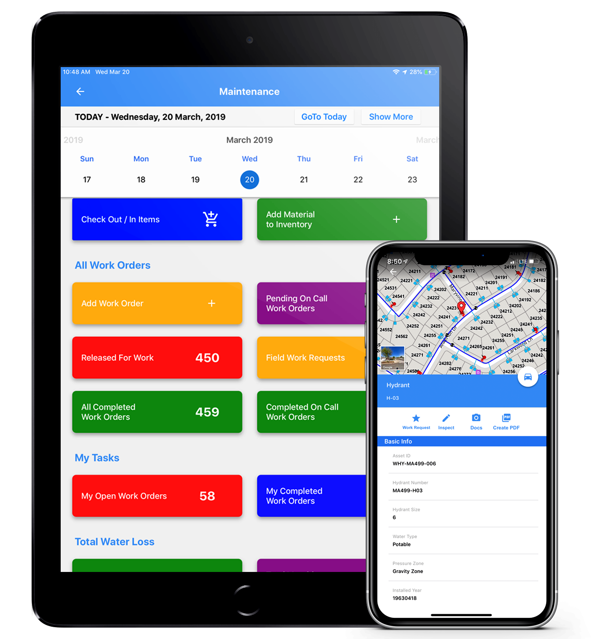
Learn MoreYour field crews don’t want complicated, but still you need to keep better track of what happens during the day.
With GeoViewer Mobile, assigning and completing work couldn’t be simpler. Communicate in real time, sending information back and forth to the field immediately, while tracking inventory, costs. Integration with billing systems.
No connectivity? Don’t worry, GeoViewer will sync when you get back to a connection.
Learn MoreGeoViewer Extension Modules deliver powerful tools to streamline many of the operational procedures within your organization. Feature rich extensions integrate many disparate, traditionally unorganized processes that cost your city valuable time and money.
Learn MoreInterested?
We understand that many organizations simply cannot replace existing legacy systems like billing or asset management, but managers have an almost impossible task of unifying multiple systems. GeoViewer supports many integrations with many different systems to make accessing and analyzing information simple and fast.